Kikuchi: An Introduction
The Kikuchi region extends across vast fertile plains in northern Kumamoto Prefecture. Flowing out of the mountains northeast of the plains and through this pastoral landscape is the Kikuchi River, providing water for rice cultivation for more than two millennia. Agriculture remains at the core of local life and culture. Much of this cultural heritage can be traced back to the days of the Kikuchi clan, which controlled most of central Kyushu from the eleventh until the early sixteenth century. The Kikuchi headquarters was the castle town of Waifu, today the city of Kikuchi.
The rise of the Kikuchi clan
The Kikuchi clan is thought to have been founded by Fujiwara no Noritaka, a high-ranking court official. In 1070, Noritaka’s superiors at Dazaifu, the administrative center of Kyushu near what is now the city of Fukuoka, appointed him to oversee an agricultural estate (shoen) owned by the court in what is now the Kikuchi district. Noritaka changed his surname to Kikuchi and built a fortified compound on the river that later took the same name, laying the foundations for the castle town of Waifu and for the rice trade that was to bring prosperity to his descendants and expand Kikuchi ascendancy far and wide.
Noritaka’s successors extended their clan’s influence through skillful diplomacy and success on the battlefield. They acquired great wealth by monopolizing trade on the Kikuchi River and selling crops grown on the surrounding plains, which they developed into some of the most productive farmland in the country. The Kikuchi reached the height of their prosperity in the fourteenth century, when the imperial court split into two as the result of a power struggle, and the rival Northern and Southern courts fought for control of the country. The Kikuchi were staunch supporters of the Southern Court, whose emperor sent his young son, Prince Kaneyoshi, to Kyushu to strengthen existing alliances and cultivate new ones.
A cultural legacy
On Prince Kaneyoshi’s arrival in Waifu in 1348, the Kikuchi planned entertainments befitting a member of the imperial court. A celebratory New Year’s performance called matsubayashi—modeled on performing arts enjoyed by the aristocracy, with dancing accompanied by singing, drums, and flutes—inaugurated a tradition that survives today. For more than 650 years, the entertainments witnessed by the prince have been reenacted annually on a stage in front of a giant muku (Aphananthe aspera) tree in central Kikuchi. The tree is said to have been planted by Prince Kaneyoshi, or to have grown from a staff he stuck in the ground. During the matsubayashi performance, held on October 13, spectators are not allowed to enter the area between the stage and the tree so as not to obstruct the prince’s view.
The Kikuchi clan’s fortunes declined gradually after the Southern Court was defeated in the late fourteenth century. They then directed their efforts toward supporting local culture and providing education for samurai and townspeople. This tradition survived even after the Kikuchi were vanquished by rival warlords in the early 1500s. Statues of Kikuchi heroes dot the streets of the modern-day city of Kikuchi, and a shrine dedicated to these historic figures stands on the hilltop site of what was once the clan’s castle.
Dramatic scenery
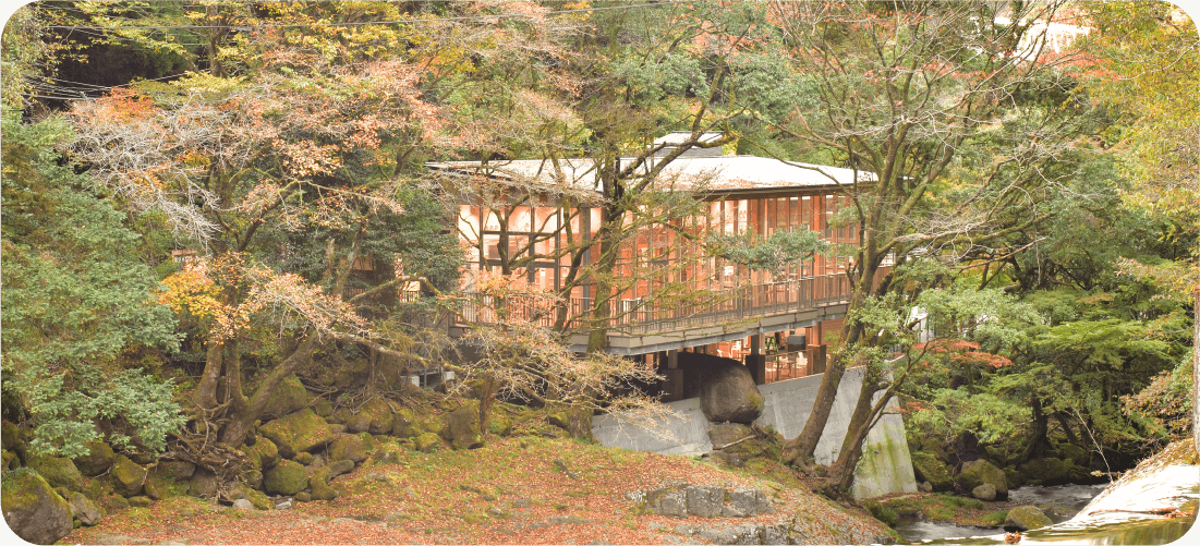
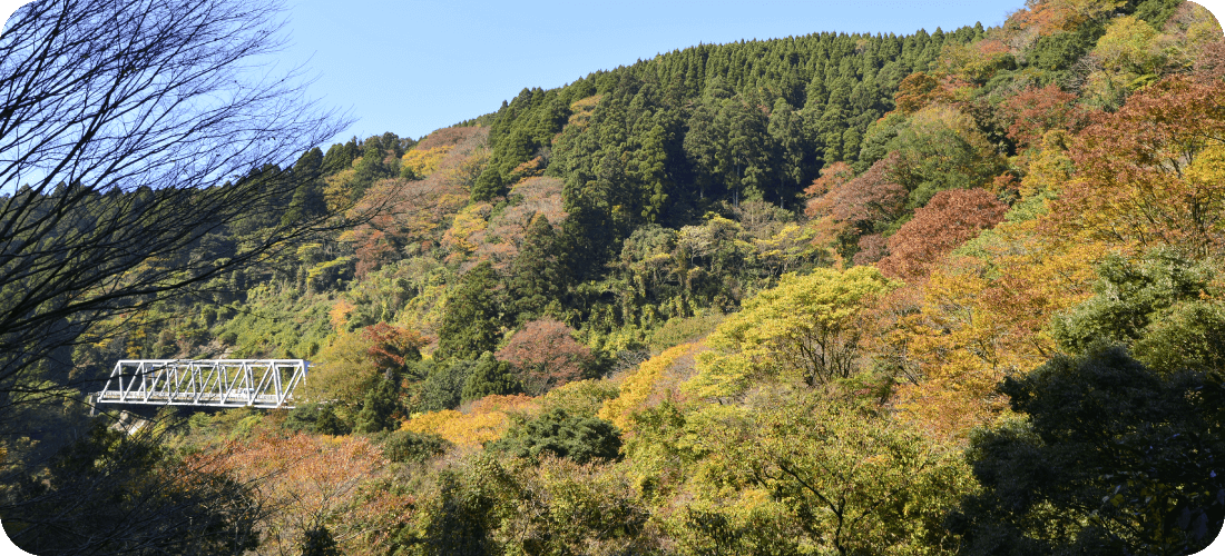
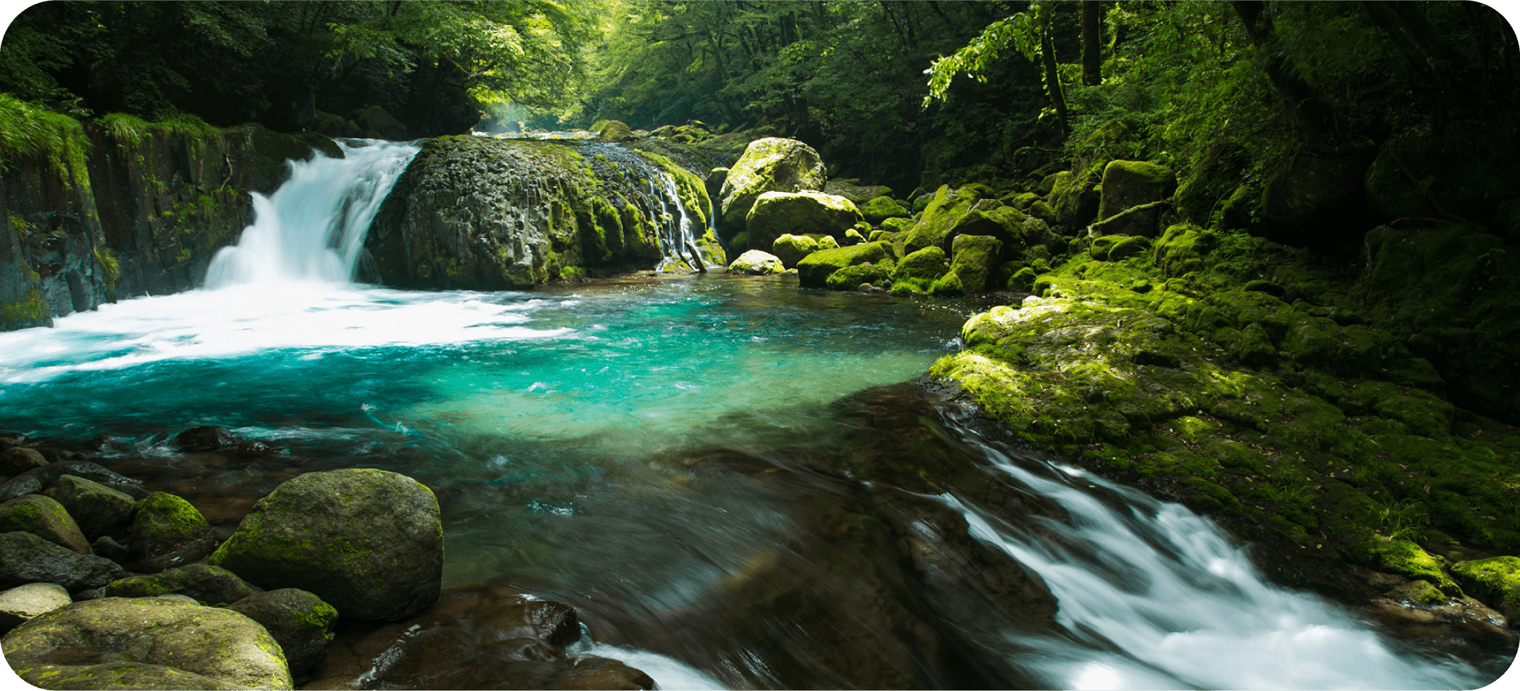
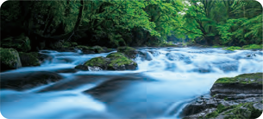
In the eighteenth century, Kikuchi became famous for the dramatic scenery of its mountainous northeast. Once an inhospitable wilderness used as a training ground by ascetics who would retreat into the mountains in pursuit of spiritual discipline, the scenic beauty of the Kikuchi Gorge in the uppermost reaches of the Kikuchi River was first described in a 1772 travelogue. Its landscape includes waterfalls and several types of native woods that nurture a great diversity of plant and animal life. Today, the gorge is a popular hiking destination with a modern visitor center providing informative exhibits on the natural environment of Kikuchi.
Kikuchi Gorge
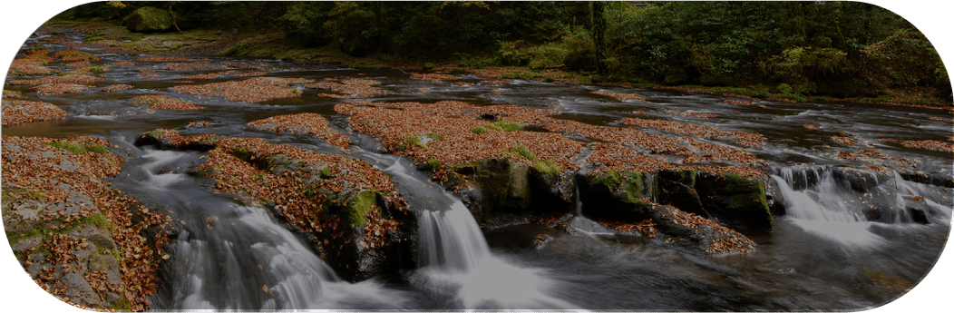
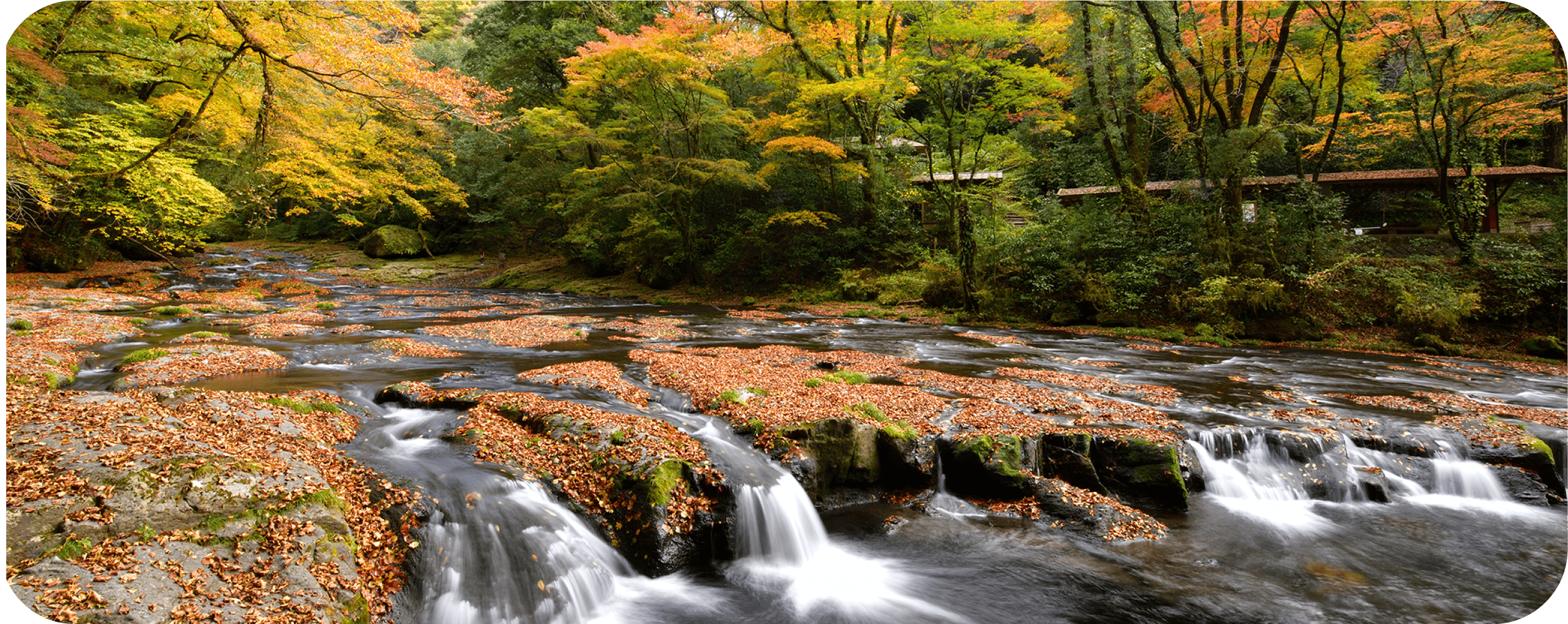
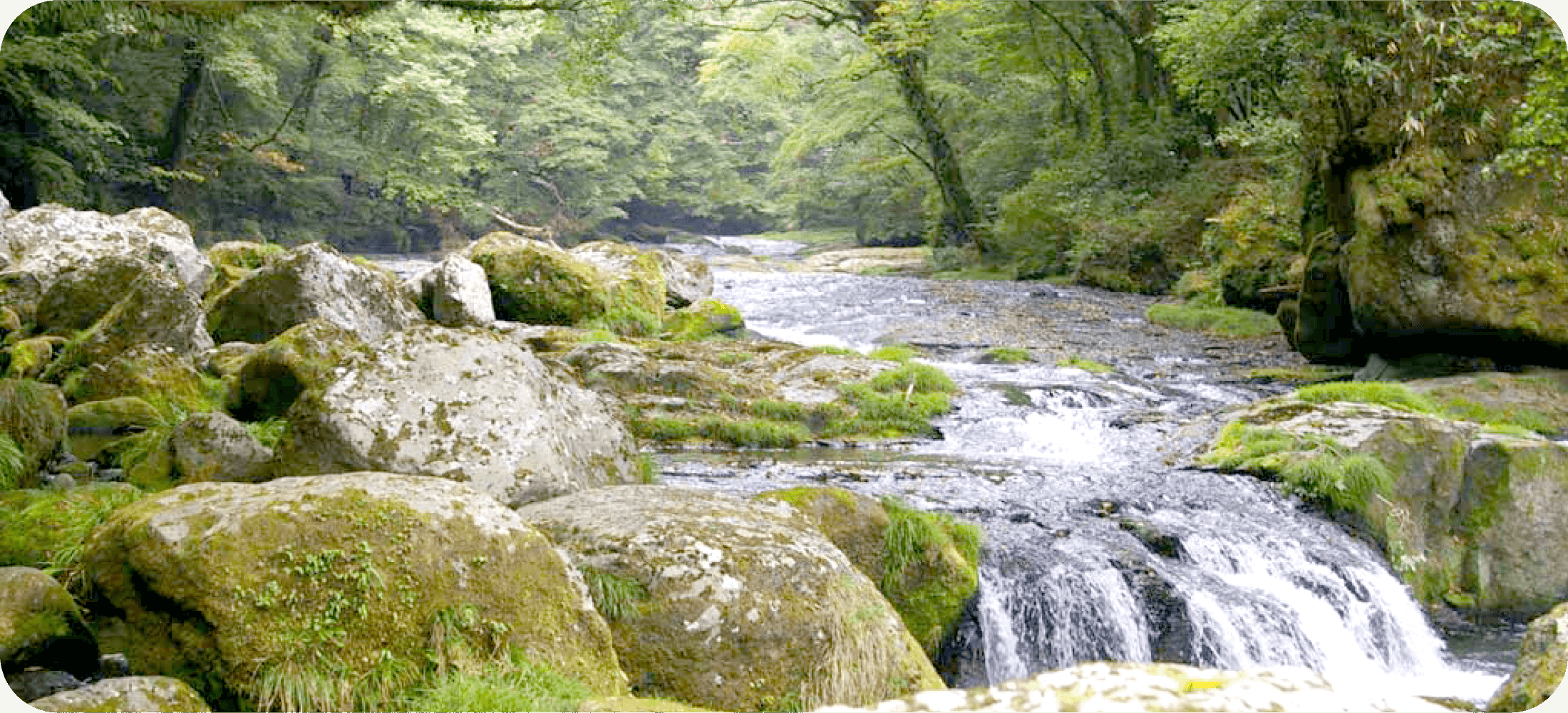
The 4-kilometer Kikuchi Gorge cuts a straight line through dense forest on the eastern edge of the municipality of Kikuchi, a 20-minute drive from the city proper. The gorge is a tranquil hiking spot noted for its distinctive scenery, with waterfalls alternating with long sections of gently flowing water. This landscape, and the great diversity of plant and animal life in the area, are products of the gorge’s topography and its volcanic origins.
A tale of many climates
The gorge is the source of the Kikuchi River, which flows southwest across the Kikuchi Plain for 71 kilometers before reaching the Ariake Sea. The river and gorge take shape at an altitude of 800 meters, at the convergence of countless streams originating in mountains on the outer rim of the Mt. Aso caldera. Flowing downhill from there, the river reaches an altitude of 500 meters at the end of the gorge. The 300-meter change in elevation over a distance of only 4 kilometers means significant biodiversity in the gorge, from fir and oak forest in the cold upper reaches to evergreen broadleaf trees in the lower temperate parts. This range of climatic conditions and the coexistence of forest and river ecosystems attracts a wide range of small mammals, frogs and lizards, birds, and insects.
A landscape in constant flux
The dramatic series of steep waterfalls is the result of ancient eruptions of the Mt. Aso volcano, located southeast of the gorge, and the ceaseless flow of water over tens of thousands of years. The volcano experienced four massive eruptions between 270,000 and 90,000 years ago. Volcanic matter unleashed by these eruptions piled up in the valley that was to become Kikuchi Gorge. This matter—mainly hot, thick ash—solidified, forming a type of rock called welded tuff.
As welded tuff cools, the rock contracts and its surface cracks. As this cooling progresses, the cracks deepen and form columnar joints. Water flowing over the rock eventually penetrates these fissures and causes blocks to break off, leaving sheer cliffs that become waterfalls. The vertical breaks in the rock are visible throughout Kikuchi Gorge, as are giant boulders that have fallen from the mountainsides due to erosion and tumbled into the river.
The combination of the river’s comparatively steep flow and the welded tuff’s tendency to break off in large pieces means that the landscape in Kikuchi Gorge is in constant flux. The rock visible in the gorge today is thought to be approximately 270,000 years old, produced by the first of Aso’s great eruptions—the newer layers have already been swept away by the water.
The Water in Kikuchi Gorge
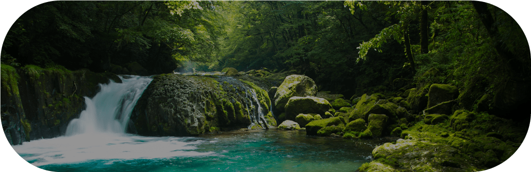
Countless streams that originate in mountains to the northwest of the Mt. Aso volcano converge in Kikuchi Gorge to form the Kikuchi River. The water in the gorge is clear and cold, typical of secluded rivers at high altitudes. What makes this river distinctive is its almost complete lack of active volcanic chemicals and its low magnesium and calcium content.
The Kikuchi River takes shape over 800 meters above sea level, near the northwestern ridge of the Mt. Aso caldera’s outer rim. The river’s sources are all on the outer slope of the caldera, and are also situated at an altitude significantly higher than the caldera floor. Consequently, chemicals derived from the active volcano are unable to enter the Kikuchi watershed. The water is, however, filtered by layers of the ancient volcanic rock that form the caldera walls. This combination of geography and geology result in the pure, soft water for which Kikuchi Gorge is famed.
The interplay of clear, low-mineral water and volcanic rock in the gorge also affects the river’s appearance. In places where the riverbed consists of light rock, the water looks cobalt blue—caused by sunlight passing through it and reflecting off the rock without interference from substances in the water.
Access to an abundance of pure water carried downstream by the Kikuchi River is the main reason that the Kikuchi Plain has been able to support large human settlements for more than 2,000 years. The river and the fertile fields around it have made Kikuchi one of the most productive rice-growing regions in Japan, and the prized soft water flowing down from Kikuchi Gorge once supported a thriving sake brewing industry.
Kakemaku Falls
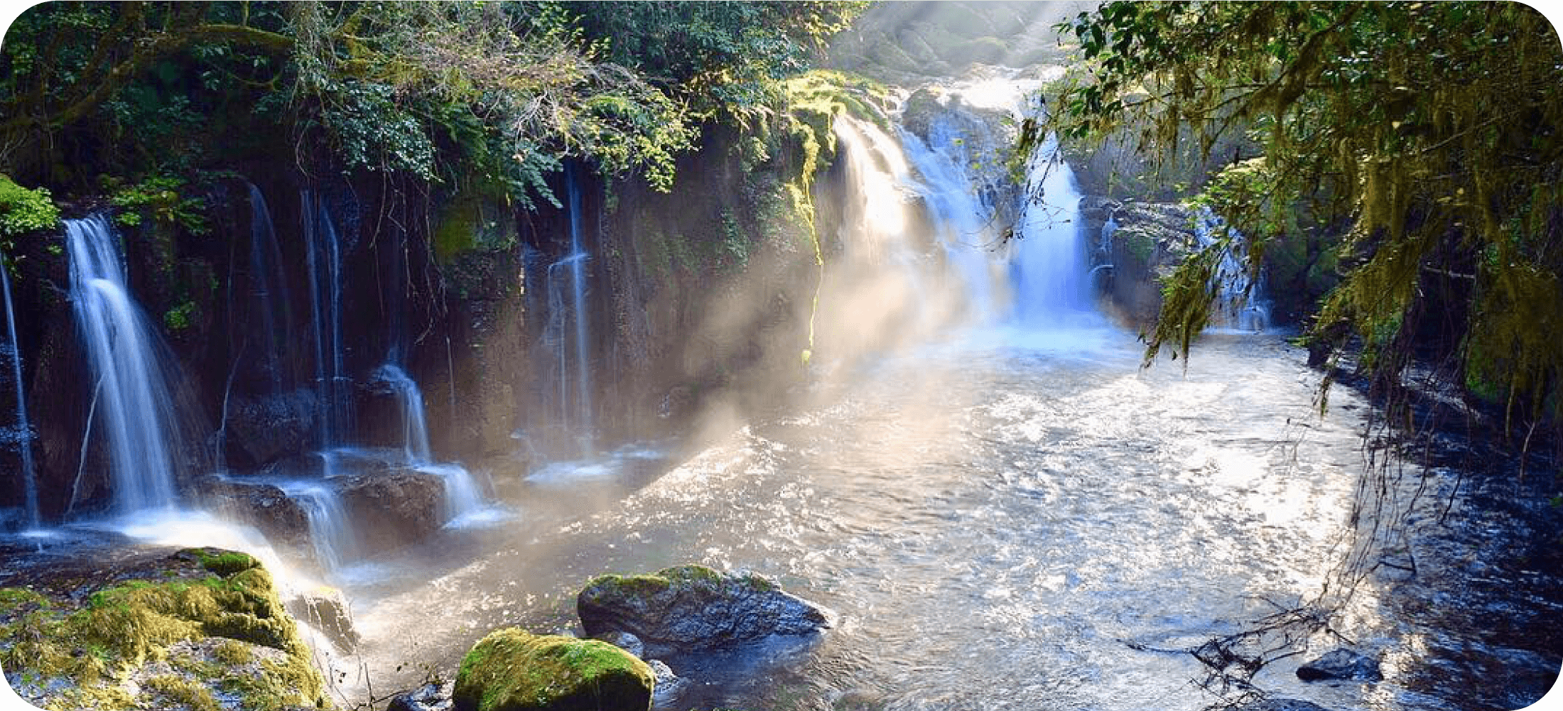
The 20-meter Kakemaku Falls is the highest waterfall in Kikuchi Gorge. It is located near the gorge’s visitor center, directly underneath a bridge from which the lower end of the gorge can be viewed through the spray rising from the pool at the base of the waterfall. Under the right conditions, this scene may be enhanced by a rainbow appearing in the spray.
Kakemaku Falls is one of the best examples of the type of steep waterfalls for which Kikuchi Gorge is noted. The volcanic rock in the gorge contains vertical fissures that were caused by extremely hot matter from a volcanic eruption interacting with cool air. Water eventually finds its way into these cracks, causing rectangular blocks of rock to break off. The resulting sheer cliffs become waterfalls like this one.
The name of the falls means “lowered curtain”—a reference to how the falling water conceals the cliff behind it like a grand curtain separating a stage from the audience.
Reimei Falls
Reimei Falls is the first waterfall along the walking path that starts from the Kikuchi Gorge visitor center and is perhaps the most photographed feature of the gorge. Usually, the water flows down only one side of the giant moss-covered boulder at the center of the waterfall, but several additional cascades form around this boulder when the river’s water level rises, such as after rain. The waterfall’s relatively gentle drop of 5 meters produces a delicate spray said to resemble mist at daybreak—hence the name reimei, which means dawn.
The pool underneath the falls is generally calm and it is possible to walk quite close to the main waterfall to take in the roar of the water. From the falls, the walking trail heads upward into a grove of cedars planted in 1823 by the local daimyo lord, intended for use as construction material. Left standing, these trees now tower high above the river and provide a habitat for the Japanese giant flying squirrel (musasabi). The squirrels climb the trees using their sharp claws, leaving the bark ragged in spots.
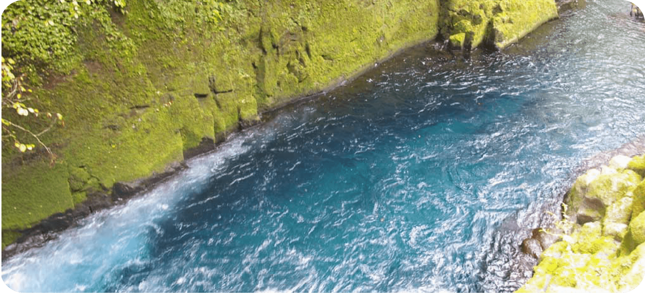
Ryugabuchi Pool
The tranquil Ryugabuchi pool is located by a bridge where the shorter of the two walking paths in Kikuchi Gorge turns back toward the visitor center. The water in the pool appears a bright shade of blue, especially on clear days when the sun lights up the surface. This color is the result of clear water low in minerals flowing over the relatively light-colored rock that makes up large sections of the gorge’s riverbed.
Upward from the bridge along the longer walking path, in the shade provided by zelkova and maple trees, grows a type of spider lily known as kitsune no kamisori—literally, “Fox’s razor” (Lycoris sanguinea). In early spring, the lilies send up long thin leaves with sharp edges imagined to resemble straight razors, on which foxes could trim their fur while roaming the forest. The orange flowers bloom in August, after the leaves have all wilted.
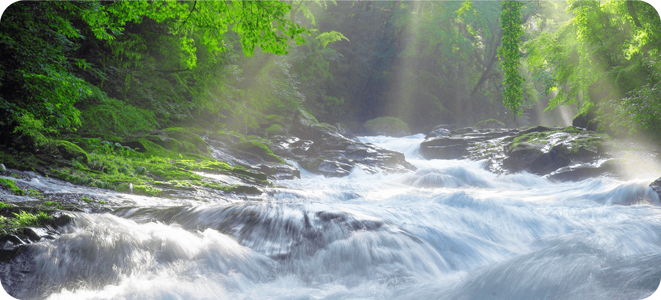
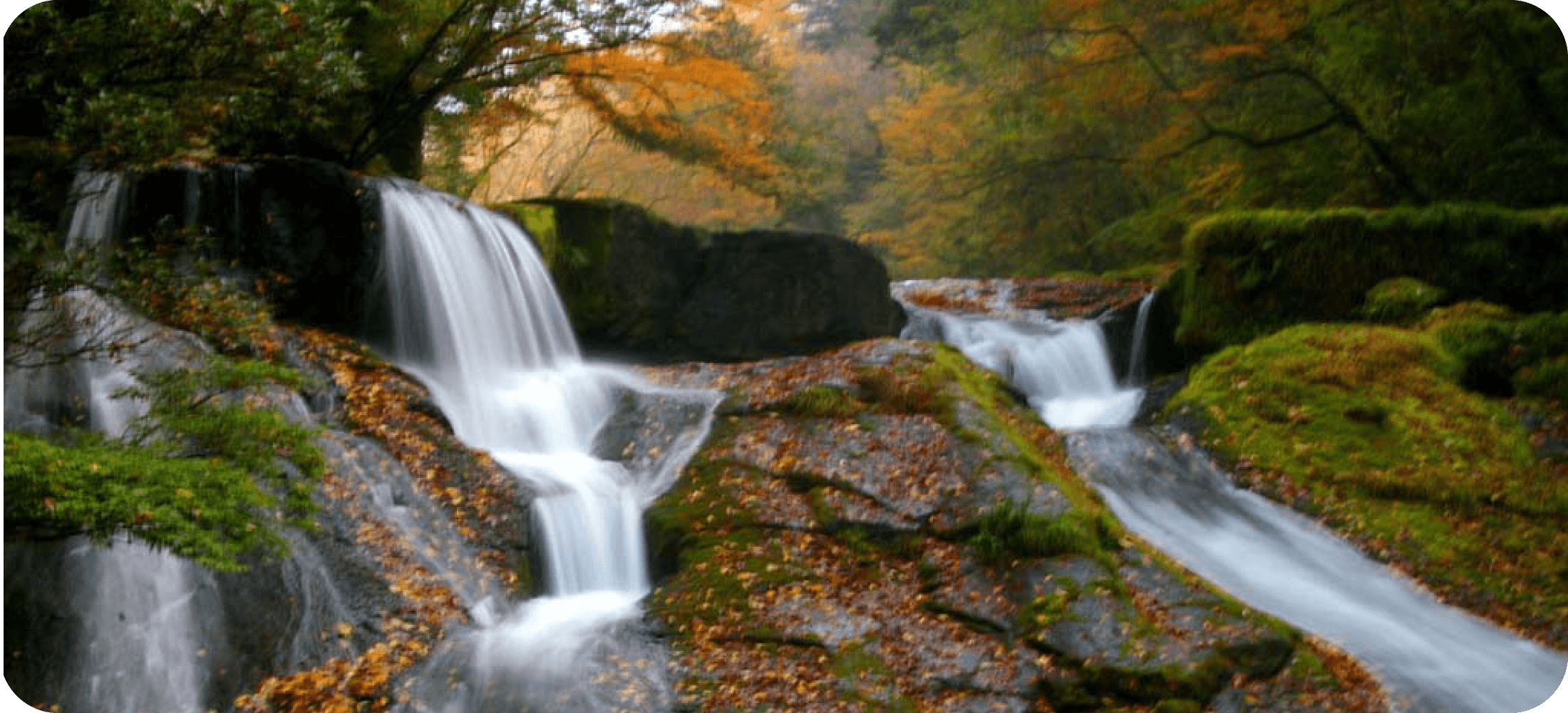
Tengu Falls
The eight-meter-high Tengu Falls is one of the largest and loudest waterfalls in Kikuchi Gorge, with water rushing over a staircase-like rock formation before crashing into the Ryugabuchi pool below. A bridge over the pool offers an unobstructed view of the falls, which is also visible from walking paths on both sides of the river.
In the past, Tengu Falls was largely obscured by a dense thicket—a habitat believed to be ideal for the legendary tengu. These long-nosed, goblin-like creatures are associated with mountain asceticism. Centuries ago, the falls are thought to have been part of a training ground for devotees of the syncretic religious tradition of Shugendo, who would retreat into the wilderness for long periods in pursuit of spiritual discipline. Believers who were engaged in ascetic practice in the nearby mountains would occasionally stop by Tengu Falls to purify themselves in the cold water.
Yonjusanman Falls
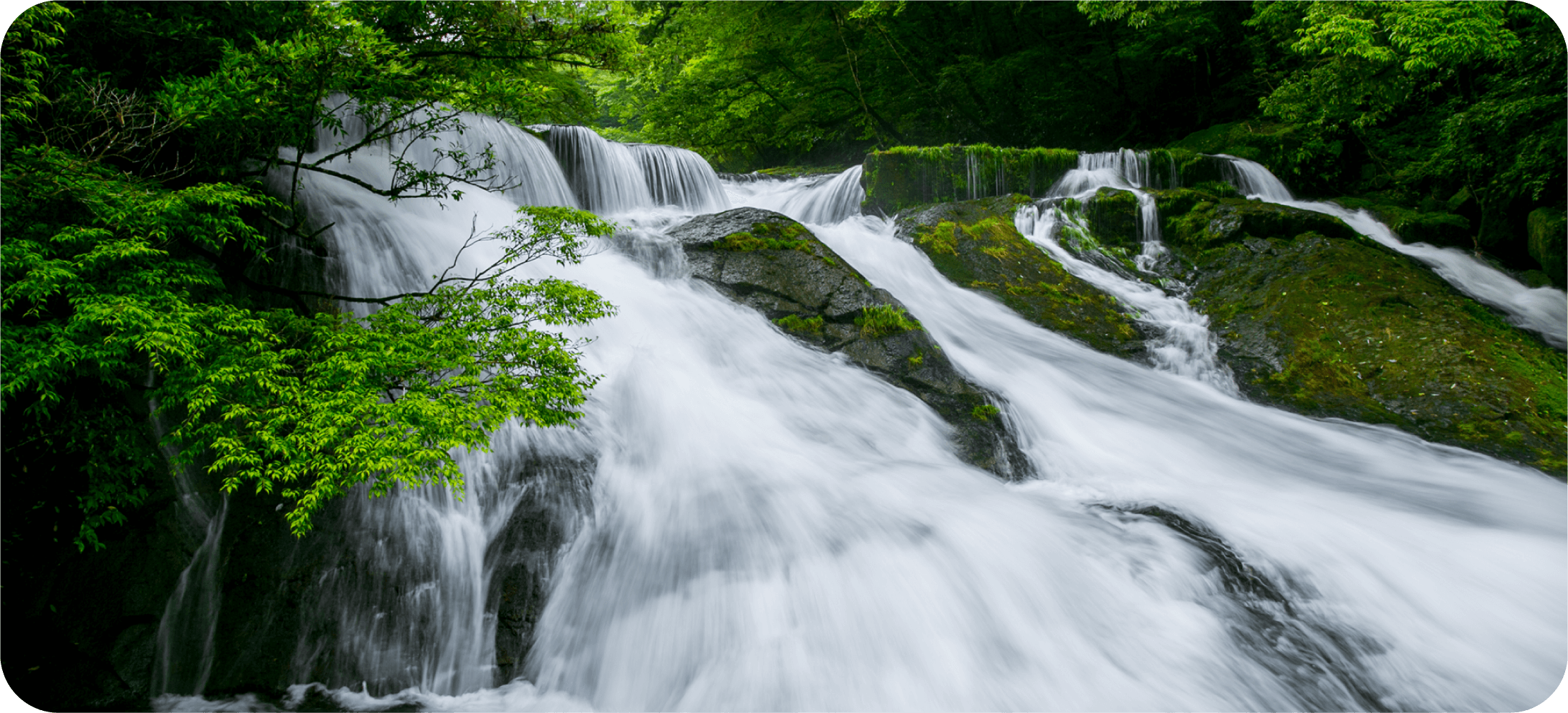
Yonjusanman (“four hundred and thirty thousand”) Falls is the last major waterfall along the longer walking path through Kikuchi Gorge before the trail turns back toward the visitor center. The falls is made up of a series of cascades in various shapes and sizes and gets its name from the average amount of water flowing through it in a single day: 430,000 koku, equivalent to 78,000 metric tons.
It is possible to walk into the middle of the falls by hopping from rock to rock, but the rocks can be slippery. Firs, Japanese torreya (kaya; Torreya nucifera), and other conifers that require a cool climate and are thus absent in the warmer lower reaches of the gorge, grow on the mountainside near Yonjusanman Falls.
Hogan Keyaki Tree
After passing Yonjusanman Falls, take a few steps uphill from the longer of the two walking paths in Kikuchi Gorge to reach the towering Hogan Keyaki, a zelkova (keyaki) tree that grows on top of a massive boulder. The tree’s thick roots, clinging to the volcanic rock like a giant’s fingers, have become almost completely exposed due to erosion. Water flowing down the mountainside has slowly washed away the soil around the boulder, leaving the tree perched on it several meters above the ground.
Zelkova trees are traditionally believed to possess a mystical energy because they are hardy and can grow very large on relatively little nutrition. Particularly impressive specimens, such as the Hogan Keyaki, were often thought to be the abode of divine spirits.
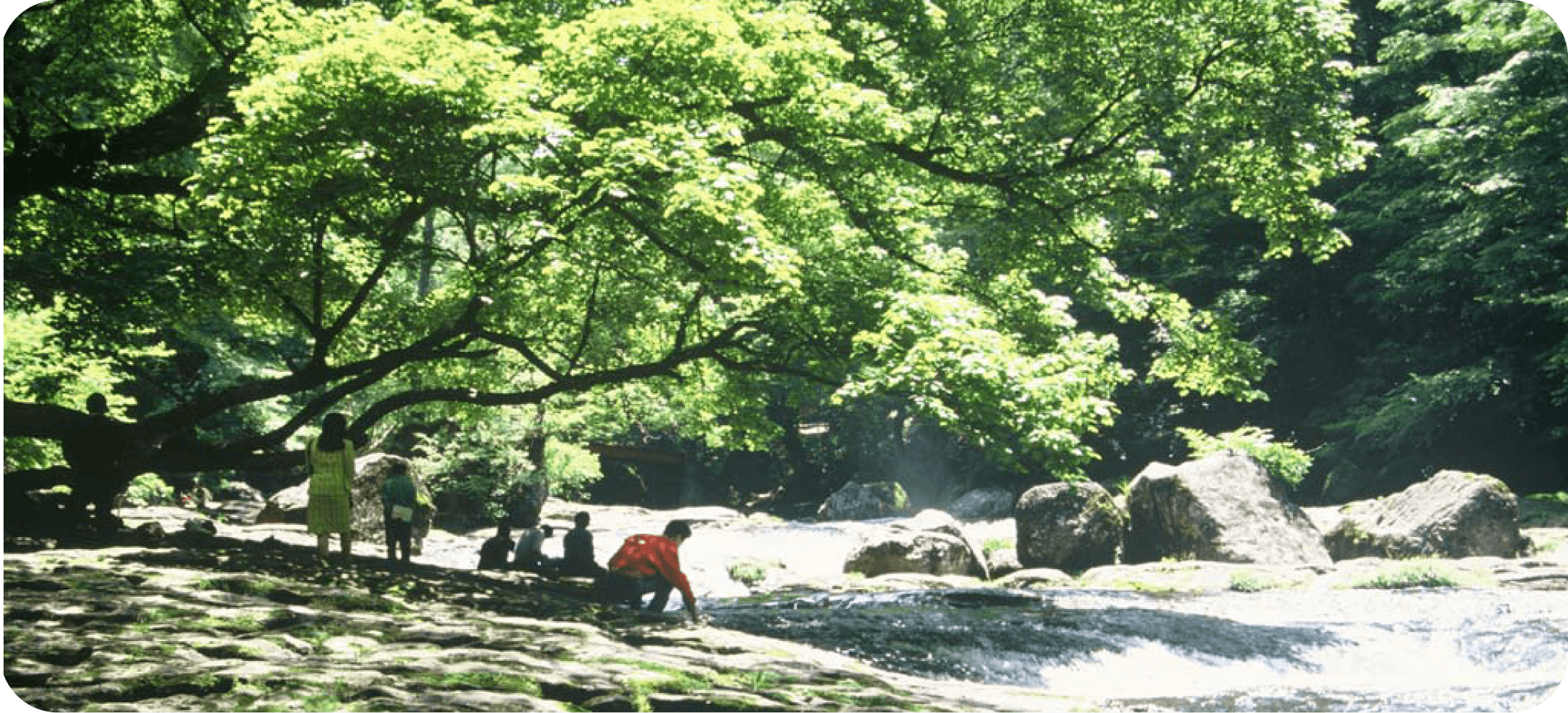
Hirokawara
The longer of the two walking paths through Kikuchi Gorge turns back toward the visitor center at Hirokawara, a wide section of the river where the water is shallow and flows relatively slowly. Here the path snakes between pools inhabited by frogs, small salamanders, and water insects. It also passes over rocky ground broken into a conspicuous grid pattern. The rock is some 270,000 years old, formed from volcanic ash unleashed by an eruption of nearby Mt. Aso. The grid pattern was formed when the welded rock cooled and cracked, and the cracks slowly deepen as water flows over them.
Yamame (landlocked masu salmon), one of the only two species of fish living in Kikuchi Gorge, can sometimes be seen in the pools under the bridge at Hirokawara. Also occasionally visible from the bridge, particularly in the upstream direction, are green tufts of kawanori, a type of edible algae that grows in rivers. Kawanori has been part of the local diet since antiquity, and algae harvested from Kikuchi Gorge was once considered a delicacy. The daimyo lord of the Kumamoto domain would present local kawanori as a gift to the shogun during the Edo period (1603–1867). The plant is increasingly rare these days, and Kikuchi Gorge is one of the few places where it still grows.
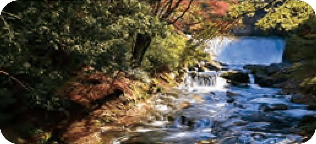
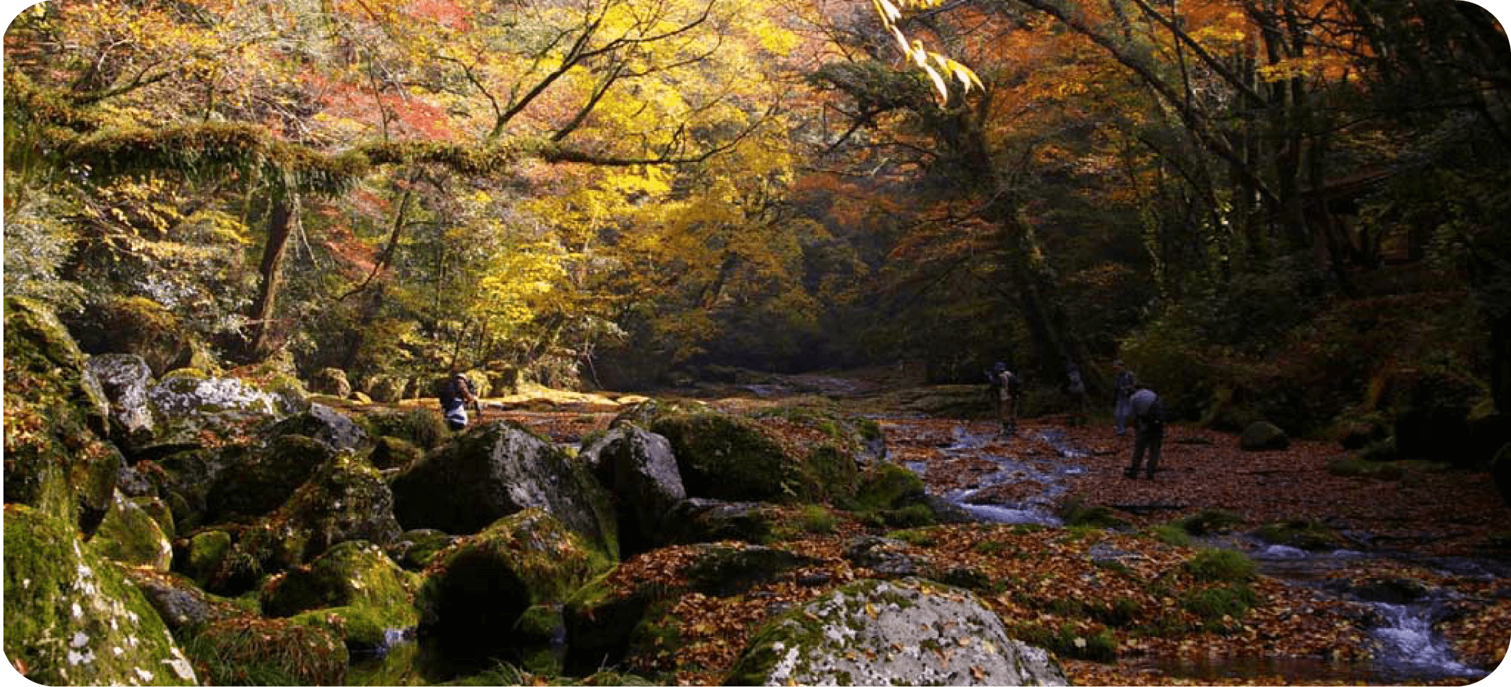
Momijigase
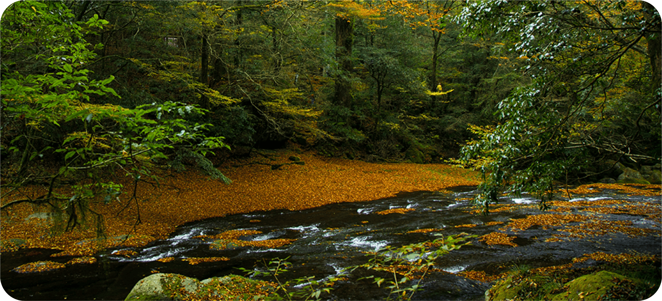
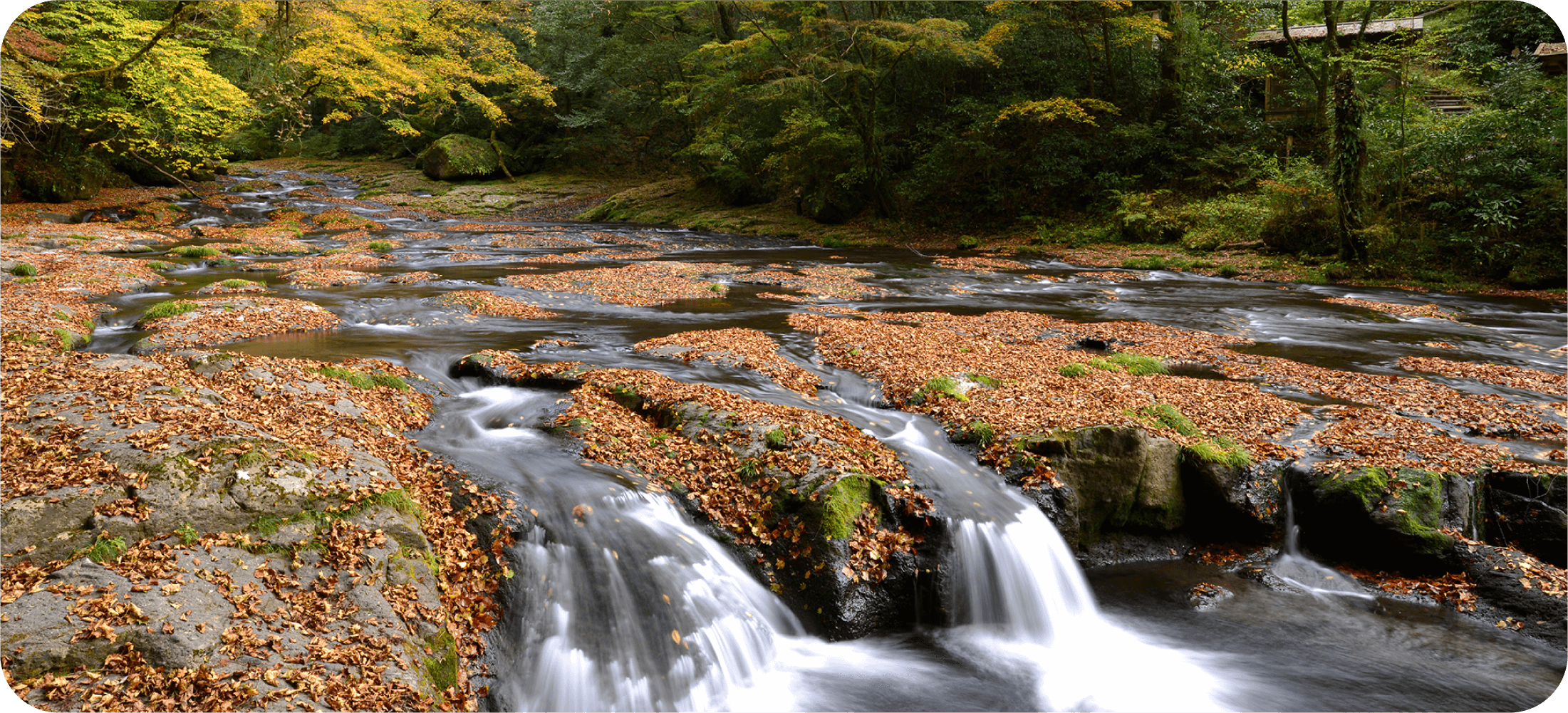
Momijigase (“maple shallows”) is a tranquil and shaded section of Kikuchi Gorge. It is located above Reimei Falls, just downstream from the bridge that marks the turning point of the shorter walking path in the gorge. The place is named after the many maple trees that grow on both sides of the river, extending their branches over the rapids. Momijigase is a particularly popular destination in autumn, when the foliage turns brilliant red and orange. When the leaves fall, they occasionally form a colorful carpet along the water. The thick moss cover and cool shade in summer are also noteworthy.
Footpaths from the main trails on both sides of the river lead down to the water’s edge, and it is possible to walk a few dozen meters along the rocky riversides. Extra care should be taken when close to the water, as some sections of the path are often slippery.
Diverse Plant Life in Kikuchi Gorge
Kikuchi Gorge is famous for its diverse plant life. The changes in elevation from one end of the 4-kilometer gorge to the other result in a wide range of growing conditions. The lower end of the gorge is 500 meters above sea level, while the elevation at its starting point is 800 meters. Walking uphill through the gorge, you can see how the vegetation changes gradually from tall evergreen trees to deciduous species, and then on to conifer and beech forest in the upper reaches. In total, an estimated 750–800 plant species, of which 250–300 are trees and shrubs, grow in Kikuchi Gorge.
Warm-temperate forest covers the lower parts of the gorge. Common trees in this zone include the Japanese cinnamon (yabunikkei; Cinnamomum yabunikkei), whose dark-green leaves are fragrant and glossy with three distinctive veins; the urajiro-gashi (“white back”) ring-cupped oak (Quercus salicina), so named because its thick, leathery leaves are whitish on the back side; and the isunoki witch hazel (Distylium racemosum), whose tiny red, petalless flowers bloom in dense clusters from March to April. Deciduous trees such as zelkovas and various species of maple are common in the middle part of the gorge, as are Japanese cedars. Near the Momijigase area is a noteworthy grove of giant cedars planted in 1823 by the local daimyo lord, intended for use as construction material.
Up beyond the Hirokawara area, where the gorge’s walking paths end, grow conifers, including firs and the southern Japanese hemlock (tsuga; Tsuga sieboldii), a popular ornamental tree that bears small reddish-brown cones on its outer branches. A deciduous tree known as inushide (Carpinus tschonoskii) also grows here; it is a species of hornbeam with densely double-serrated leaves and a smooth but sinewy trunk sometimes described as “muscular.” Deciduous trees such as beeches and the mizunara oak (Quercus crispula) appear even higher up the mountain, where average temperatures are significantly lower than in the warm-temperate zone.
Two plants readily visible along the walking paths are the thread-like bright-green kiyosumi-ito moss (Barbella flagellifera), which thrives in the wet and humid conditions near the river and hangs down as much as 20 centimeters from tree branches and rocks throughout the gorge, and the iwatabako (“rock tobacco”; Conandron ramondioides), a species with large, tobacco-like leaves that flourishes on damp rocks. Its star-shaped, light purple flowers bloom in summer.
Mammals in Kikuchi Gorge
Kikuchi Gorge is a haven for animals that thrive in areas where forest and river ecosystems intersect. The gorge’s mammal residents represent some 20 species and include mice, moles, bats, martens (ten), giant flying squirrels (musasabi), and raccoon dogs (tanuki). As most of these animals are small and active mainly at night, they are seen only infrequently by visitors. Two of the most distinctive mammals in the gorge are dormice (yamane) and water shrews (kawanezumi).
The nocturnal yamane dormouse (Glirulus japonicus) grows to be 6.5 to 8 centimeters long and has a thick and fuzzy tail around 5 centimeters in length. Its fur is pale brown with a black stripe down its back, and it spends most of its time in trees, feeding on berries, nectar, and insects. Thanks to the small curved claws on its fingers and toes, it can run very fast upside down along the underside of tree branches. The dormouse hibernates for up to five months and lives between three and six years. While not a threatened species, it is scarce in Kyushu and has been designated a Natural Monument.
The kawanezumi water shrew (Chimarrogale platycephalus) is the only land mammal in Japan that gets its prey mainly from freshwater sources. Between 11 and 14 centimeters in length, it has dense and short grayish-black fur, and fringes of flattened, stiff hairs on both lateral edges of each finger and toe, which act as paddles. It swims in the river under the cover of darkness, hunting for aquatic insects, small crabs and shrimp, and fish. Rapidly flowing waters interspersed with calm pools, like the environment in Kikuchi Gorge, are its preferred habitat. The water shrew is common throughout Honshu but relatively rare in Kyushu and entirely absent from the island of Shikoku.
Amphibians and Reptiles in Kikuchi Gorge
Most amphibians such as frogs and salamanders begin their lives in or near water, grow up and spend their adulthood in damp forests, and return to the water to lay their eggs. Areas such as Kikuchi Gorge, where the two environments merge, are ideal habitats for them and also attract reptiles, some of which feed on amphibians. These are some of the common amphibians and reptiles that inhabit the gorge.
The Hynobius oyamai salamander (chikushibuchi sanshouo) dwells on the forest floor and in clear streams throughout the gorge. It hides under rocks during the day and comes out only at night to hunt for woodlice and other insects to feed on, making sightings rare. Adult salamanders are between 11 and 15 centimeters long and bluish-gray. The Hynobius oyamai lays its eggs in pouches underneath rocks in the water from April to May, and in summer its younglings can often be seen swimming in streams and pools where they hunt for aquatic insects. In autumn, the adolescent salamanders move to the forest, altering their diet. The Hynobius oyamai is thought to exist only in northeastern Kyushu.
The dark-brown tago frog (tagogaeru; Rana tagoi) is the most common frog in Kikuchi Gorge. About 5 centimeters long, it is usually seen near small pools and puddles by the river. The frog lays its eggs in underground streams because its pearly white tadpoles require complete darkness to grow, feeding solely on the nutrients in the egg from which they emerge. They develop a pigment gradually before rising from the water as adolescents. Another frequent sight in the gorge is the local species of common toad (Nihon hikigaeru; Bufo japonicus), which can grow up to 18 centimeters long, making it the largest frog in Japan. Its black tadpoles can be spotted swimming in pools along the gorge’s walking paths. Less easy to find is the kajika frog (kajikagaeru; Buergeria buergeri), which is noted for its melodic cry. This song, used by male frogs to call females during mating season from April to July, is cited as a symbol of early summer in Japanese poetry.
Two noteworthy residents of the damp forest floor, which is covered with decomposing fallen leaves, are the akahara fire belly newt (akaharaimori; Cynops pyrrhogaster) and the takachiho odd-scaled snake (takachihohebi; Achalinus spinalis). The former, a small lizard-like salamander often seen lounging in pools and puddles near the river, is distinguished by its red and black belly. The exact color pattern is unique to each individual and remains almost unchanged throughout the newt’s lifespan, which can be up to 25 years. Though the red hue is a sign of poison, this animal’s toxin is generally not dangerous to humans. The dark-gray odd-scaled snake, on the other hand, has no poison and tends to stay out of sight, moving about mainly at night in search of earthworms, its preferred food.
Birds in Kikuchi Gorge
More than 60 species of birds live in or visit Kikuchi Gorge throughout the year—a diversity made possible by the proximity of thriving forest and river ecosystems in the gorge. Many of the species avoid humans and stick to areas where few hikers tread. But casual observers can still catch a glimpse of the local birdlife and, especially in summer, hear the singing of several distinctive winged visitors.
Common birds living in trees around the Kikuchi River year-round include the yamagara tit, distinguished by its gray back and wings, chestnut-colored belly, and black and white head; the shijukara tit, which has a yellow-green back, blueish-gray wings, and a black head with white cheeks; and the light-brown and gray stubby-billed enaga or long-tailed tit. Often seen close to the water are the gray wagtail (kisekirei), whose back is gray and belly a bright lemon yellow, and the black and white crested kingfisher (yamasemi), which grows up to 40 centimeters long and sports a prominent spiky crest on its head. The upper end of the gorge is the domain of the mountain hawk-eagle (kumataka), an imposing dark-brown raptor with a wingspan of up to 175 centimeters. This apex predator’s presence indicates a healthy ecosystem with a well-developed food chain.
These permanent residents are joined by a variety of migratory birds in late spring and summer, when the song of the vividly colored blue-and-white flycatcher (oruri), traveling from Southeast Asia, can be heard throughout the gorge. This species has been celebrated for its fluid, melodic song and kept as a pet at least since the Edo period (1603–1867), when it came to be considered one of Japan’s “three great singing birds,” along with the Japanese bush warbler (uguisu) and the komadori robin. A larger songbird that also journeys to Kikuchi Gorge in summer is the lesser cuckoo (hototogisu), evoked by poets for more than a millennium for its cry—a brief, four-part repeating phrase of “kwer-kwah-kwah-kurh.”
The gorge is much quieter in winter, when the pale thrush (shirohara), brown on the back and whitish on the belly with a gray and yellow bill, can be seen traversing the forest floor, picking through the fallen leaves in search of food. The copper pheasant (yamadori) may also be glimpsed between the bare trees. This elegant long-tailed bird, named for its shiny brown plumage, is found only in Japan. The male is distinguished by its yellow bill and red face, while the female is smaller, with grayish-brown plumage.
Insects in Kikuchi Gorge
Diverse plant life and an abundance of fresh water sources make Kikuchi Gorge a favorable environment for a wide variety of insects. Among the more than 1,000 local species, the following are relatively easy to spot.
The small Celastrina sugitanii butterfly (Sugitani rurishijimi) emerges from its chrysalis in mid-spring, around the time when the cherry trees in the gorge burst into bloom. Its wings are dark blue on the top side and whitish-gray with small black dots on the underside. Living only for two months at most, the species is often seen around puddles near the river between March and May.
Soon after the Celastrina sugitanii’s time is over, the appearance of the white flowers of the utsugi (Deutzia crenata) shrub attracts butterflies such as the Japanese flash (torafu shijimi; Rapala arata), whose wings are deep blue on the top side while the underside is adorned by a tiger-like spot of orange and black alongside a white and brown stripe pattern; the white admiral (ichimonjicho; Limenitis camilla), distinguished by the stark white bands on its dark-brown wings; and the orange and black large map (sakahachicho; Araschnia burejana).
From April to around July, several kinds of broad-winged damselflies can be spotted flying over the rapids of the Kikuchi River, preying on tiny aquatic insects. Mnais pruinosa (asahina kawatonbo) is about 5 centimeters long with an emerald-green body and wings that vary in color from a bright orange to a barely visible gray, whereas Mnais costalis (nihon kawatonbo) has slightly darker, orange-brown wings on a metallic-blue body.
June is the season for the Luciola parvula firefly (himebotaru), a tiny beetle that is almost impossible to spot during the day but emits bursts of bright-yellow light from just after sunset to close to midnight.
Later in summer, the alpine black swallowtail (miyama karasuageha; Papilio maackii), a large butterfly with a wingspan of around 12 centimeters, can often be found around puddles and small riverside pools. Its wings are black on the top side and covered with iridescent blue or green scales. The Japanese peacock swallowtail (karasuageha; Papilio dehaanii) is similar in color but somewhat smaller, and the gap between its fore- and hindwings is less pronounced than that of the alpine black swallowtail.
Fish in Kikuchi Gorge
The clear, cold waters of Kikuchi Gorge provide a sanctuary for two species of fish. The yamame (“lady of the mountains,” landlocked masu salmon) is a fast swimmer that can grow up to 35 centimeters long. It is described as a shy species, extremely wary of potential threats, but can be seen gliding leisurely through pools in the gorge, where fishing is prohibited.
Changes in the environment of the Kikuchi River due to industrialization from the 1950s onward caused the yamame to disappear from the river’s upper reaches at one point, but restocking efforts in recent decades have paid off, and the population is now considered self-sustaining. The yamame is known to lay eggs in the broad Hirokawara area of the river, at the end of the longer walking path through the gorge, and this is also where most sightings occur. Several restaurants in the vicinity of Kikuchi Gorge serve grilled yamame, though these fish are sourced from a nearby fish farm.
Compared to the yamame, the takahaya (upstream fat minnow) is significantly smaller and somewhat more common in the gorge. Greenish-gold with a white belly, it grows up to 10 centimeters long and is found in the cold upper parts of rivers throughout western Japan. The takahaya has traditionally been a part of the everyday diet of inhabitants of mountainous areas, though it is not considered particularly tasty. As with the yamame, the Hirokawara area is the best place to try to catch a glimpse of the fish in Kikuchi Gorge.
Walking Paths in Kikuchi Gorge
Kikuchi Gorge can be explored on two walking paths that start at the gorge’s visitor center and go uphill along the Kikuchi River from there. The shorter path is approximately 1 kilometer in length and takes about 40 minutes to finish, while the longer is 2 kilometers and can be completed in 1 hour and 20 minutes. Neither trail is particularly demanding, and no special equipment is required.
From the visitor center, the shorter path crosses a bridge over the river in front of Reimei Falls, the most photographed feature of the gorge. It continues past the Momijigase shallows, an area noted for its maple trees and thick moss. Upon reaching the Ryugabuchi pool the trail traverses another bridge, this one providing a view of Tengu Falls, one of the largest and loudest waterfalls in the gorge. It then turns back toward the starting point, providing views of the river from above during a gentle descent to the visitor center.
The longer path follows the same course as the shorter one until Ryugabuchi, from where it ascends through a forested section toward Yonjusanman Falls. Beyond this series of cascades in various shapes and sizes lies the Hirokawara area, a calm part of the river where the path crisscrosses between small pools inhabited by frogs, salamanders, and water insects. A bridge over Hirokawara leads to a gazebo that marks the trail’s turning point. The path then snakes along a steep mountainside above the river before reuniting with the shorter trail at Tengu Falls.
Guided “Health Tourism” walking tours are also offered in the gorge. Please inquire about details and prices at the Kikuchi Tourist Information Center.